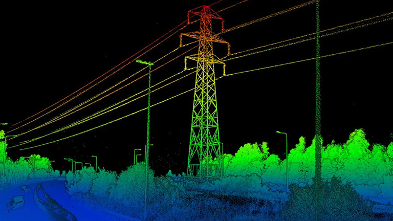
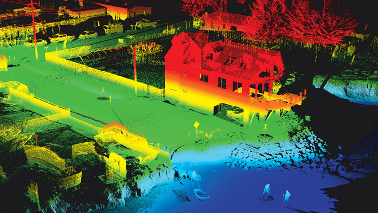
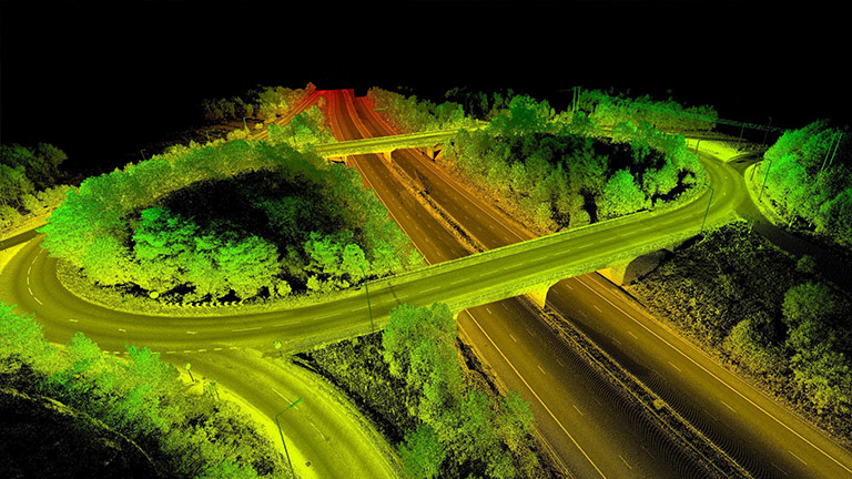
Making the world more accessible by Geospatial intelligence.

We provides comprehensive GIS services for a range of industries.

Aspiring to be the most preferred & trusted organization.

We are a leading geospatial analytics company in India, providing LiDAR, GIS & Remote Sensing, Orthophoto Generation, and Powerline Classification services. We are well equipped with cutting-edge technologies and have a certified team of experts with years of experience in the domain.

Years Experience
0 +
Why Choose Us

One stop destination for all GIS solutions.

Next Geospatial Analytics Solutions has decades of experience in the field and employs only the best specialists to ensure that your project is completed on time and on budget.

We never share any of your data with third parties and we make sure that you get the best quality possible.

Entrust your project to our team of professionals

If you’re looking for a GIS company to help you with your project, get in touch with us today!

the year of foundation
0
projects delivered
0 +
professionals and growing
0 +
on time delivery
0 %
What we do

Our Services

Aerial LiDAR

LiDAR is one of the most effective means of deriving almost any kind of Geospatial and engineering information. Our highly experienced team deliver LiDAR based products that conform to all customer and industry standards

Learn More

Terrestrial LiDAR

LiDAR acquired from land is referred to as terrestrial LiDAR. Based upon the need, industry and size of the object to be surveyed or scanned, it is either done through a fixed scanner where the scanner is attached to a tripod stand or is fixed to a vehicle/wagon. 

Learn More

GIS & Remote Sensing

We map from aerial and satellite images and toposheets. Our service is not limited to digitization but, for example, also might include preparation of a data model to creation of a geo-database with appropriate rules and thematic maps.

Learn More

Orthophoto Generation

Orthophotos are used as one important reference in GIS for mapping, feature identification and extraction. Orthophotos are prepared from aerial images by removing the tilt and relief displacement.

Learn More
Testimonial

What they say

Lorem ipsum dolor sit amet, consectetur adipiscing elit. Ut elit tellus, luctus nec ullamcorper mattis, pulvinar dapibus leo.

The power of computers to intelligent machines.

Whatever your current goals, our data analysts are here to support you at each stage of your data journey

We’re helping to automate some of the world’s most complex and difficult problems.

Lorem ipsum dolor sit amet, consectetur adipiscing elit. Ut elit tellus, luctus nec ullamcorper mattis, pulvinar dapibus leo.

Our Valued Customers

Lorem ipsum dolor sit amet, consectetur adipiscing elit. Ut elit tellus, luctus nec ullamcorper mattis, pulvinar dapibus leo.

Get Quote

Want to get a quotation? Please fill out the form. Here’s how to can reach us.